 SEGLY
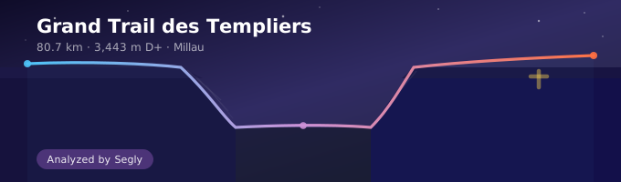
80.7 km, 3,443 m D+, three causses to cross, airy cornices above the Tarn and Dourbie gorges — the Grand Trail des Templiers is not a classic mountain race, and that's exactly what traps many runners. Here, the elevation gain doesn't explain everything: it's the terrain, the rhythm of the aid stations and the very particular logic of the course that define the race. Here's how to prepare for it.
The race profile
The Grand Trail des Templiers takes place on Sunday 18 October, starting from Millau, with staggered starts between 5:10 and 5:50.
- Distance: 80.7 km
- Elevation gain: 3,443 m
- Altitude: from 360 m (finish) to 894 m (highest point, at the start)
- 4 official aid stations: Peyreleau (~20 km, light), Saint-André-de-Vézines (~38 km, full), La Salvage (~58 km, full), Ferme du Cade (full), plus water points at La Roque-Sainte-Marguerite and Mas de Bru
For an 80 km race, the D+ isn't huge compared with an alpine ultra. It's a classic trap: many runners underestimate this race because the elevation gain looks reasonable on paper. The real challenge lies elsewhere.
What makes the Templiers different
Terrain that keeps changing
The course crosses the three causses (Noir, Méjean, Larzac), alternating rolling limestone plateaus, fast forest tracks, and technical single-track with airy sections above the cornices. These are not minor stretches: they call for attention and caution rather than speed, and a theoretical pace calculated as an average km/h means nothing there.
An effective race plan for the Templiers can't rely on a constant speed. It has to clearly distinguish rolling plateau segments, where you can push again, from cornice or technical single-track segments, where pace drops mechanically.
Concentrated blocks of elevation gain
The D+ is not spread evenly: it's concentrated on the climbs from the Tarn, Jonte and Dourbie valleys up to the plateaus. Between these climbs, long rolling sections on the causses allow you to run at a stronger pace. The profile looks more like a series of steps than a continuous climb — which makes segmenting the course especially useful to avoid being caught out.
October weather to anticipate
In mid-October on the causses, temperature swings between the early morning (start before dawn) and the afternoon can be marked, with a risk of fog or wind on the exposed plateaus. The race starts at night or at dawn: plan lighting and layers for the first hours, ready to shed them later.
Splitting the race into segments
With 4 official aid stations and 2 water points, the race lends itself naturally to a split into 5 to 7 logical segments:
- Start → Peyreleau (~20 km): initial descent and first false flat, often run too fast in the start-line excitement
- Peyreleau → Saint-André-de-Vézines (~18 km): climb towards the Causse Noir, technical terrain
- Saint-André-de-Vézines → La Roque-Sainte-Marguerite: plateau crossing, rolling section
- La Roque-Sainte-Marguerite → La Salvage (~58 km): the physically most demanding part, often where the fatigue factor is felt most
- La Salvage → Mas de Bru/Massebiau: last climb before the finish
- Mas de Bru → Ferme du Cade → Finish: final kilometres, often late in the day, with accumulated fatigue
Each segment has its own profile: elevation gain, technicality, exposure. Treating them separately, rather than reasoning in average speed over 80 km, is what distinguishes a realistic race plan from a simple estimate.
The start trap
The Templiers begin with a descent and a rolling false flat over the first kilometres. It's exactly the kind of profile that pushes you to go out too fast, carried along by the group and the start-line excitement.
The problem is that energy spent too early is paid for later, especially on the technical block from La Roque-Sainte-Marguerite to La Salvage, often identified as the hardest part of the race. A runner who has "burnt out" in the first 20 kilometres arrives at this section already drained — at the worst possible moment.
The rule is the same as on any ultra: hold back on the easy segments so you arrive fresh for the segments that count.
Handling technical sections
Cornice single-tracks require a different rhythm from a wide track. A few pointers for tackling them:
- Anticipate the slowdown. On these sections, it's not about running worse, but running differently: shorter strides, looking further ahead, no sudden surges.
- Don't try to make up lost time straight away. Trying to compensate for a technical section with an immediate acceleration on the next segment is a frequent cause of injury or cramp late in the race.
- Use poles on the climbs up to the causses. The climbs between the valleys and the plateaus are good terrain for poles, provided you're trained to use them effectively.
The fatigue factor on this course
On a course this contrasted, the slowdown in the second half is not linear: it concentrates on the technical sections and on the final climb towards Ferme du Cade, at the end of the race.
A fatigue factor around 15 to 20% is a reasonable working basis for an intermediate runner over this distance, to be adjusted based on your own history. But on the Templiers more than on a rolling course, it's better to apply this slowdown segment by segment rather than as a global average: the second half includes both rolling sections (where the slowdown is minimal) and the hardest part of the course (where it can be much more marked).
Fuelling and managing effort
With only 4 official aid stations over 80.7 km, the gaps between two points can reach 20 km — more than enough to empty your reserves if nutrition isn't planned ahead.
- Plan food and water autonomy between aid stations, especially on the Saint-André-de-Vézines → La Roque-Sainte-Marguerite → La Salvage stretch, the longest and most demanding.
- Rely on the intermediate water points to adjust hydration to the day's weather, without waiting for the full aid stations.
- Plan solid and liquid intake suited to the expected pace on each segment: you don't eat the same way on a rolling plateau as on a technical climb.
Building your race plan
The method is the same as for any ultra, applied to the particular profile of the Templiers: split the course into segments based on the aid stations and changes in terrain, estimate a base speed per segment according to elevation gain and technicality, apply your fatigue factor while strengthening it on the technical sections of the final stretch, and plan nutritional autonomy between the most widely spaced aid stations.
On a course this contrasted, doing this work by hand takes time and leaves a wide margin for error. That's exactly what Segly automates: import the official Templiers GPX, let the app segment the course (or adjust it yourself around the aid stations and technical zones), set your fatigue factor, and fine-tune the progression factor of each segment to reflect the reality of the terrain — rolling plateau, climb, or technical cornice. You get realistic split times to share with your crew, and a plan you can adjust right up to the last minute according to the forecast.
A complete race plan for the Templiers is already available. You can view an example calculated with Segly directly, with split times aid station by aid station, the fatigue factor and the terrain adjustments applied:
Key takeaways
- The moderate D+ of the Templiers (3,443 m over 80.7 km) hides demanding terrain: rolling plateaus, concentrated climbs, technical cornices.
- The hardest section is generally between La Roque-Sainte-Marguerite and La Salvage: don't arrive there already drained.
- With only 4 aid stations, plan nutritional autonomy over the longest gaps.
- Apply your fatigue factor segment by segment rather than as an average: technical terrain slows you down differently from the plateau.
- Plan lighting for the pre-dawn start and layers suited to October's temperature swings.
Also read
Ready to build your own? Import the Templiers GPX on segly.vo2run.app, segment the course around the aid stations and technical zones, and get realistic split times, ready to share with your crew. You can also look at a complete Templiers race plan for inspiration.