 SEGLY
SEGLY
5 days to go. My favorite time before an ultra. My legs feel fresh, my mind is full of scenarios, and the excitement is starting to build. This week, I’m hardly running at all—I’m focusing on preparation. And that preparation involves Segly.
Today I’ll walk you through, step by step, how I’m building my strategy for the 130 km / 7,900 m elevation gain EuskalTrail on May 15. It’s all here: the goal, the segments, the on-the-ground adjustments, nutrition, and Plan B. Buckle up.
1. The context: 130 km, 7,900 m of elevation gain, and rain

The EuskalTrail is no joke. 130 km, 7,900 m of elevation gain in the Basque Country—technical terrain, challenging mountain passes, and descents that really take a toll on your quads.
And this year, the weather isn’t helping. With five days to go, the forecast calls for rain and around 10°C. That means humidity, slippery trails, and thermal discomfort over the long haul. Nothing insurmountable, but it’s something to plan for.
2. The goal: 21 hours, with a Plan B of 23 hours
I’ve set a primary goal of 21 hours. It’s ambitious but realistic if everything goes smoothly. And because an ultra is also about knowing how to handle the unexpected, I’m working out a Plan B for 11:00 p.m. at the same time. A minor injury, a temporary slump, unpredictable weather—it’s best to have a backup plan in my pocket.
3. Open Segly: Automatic Segmenting Option #2
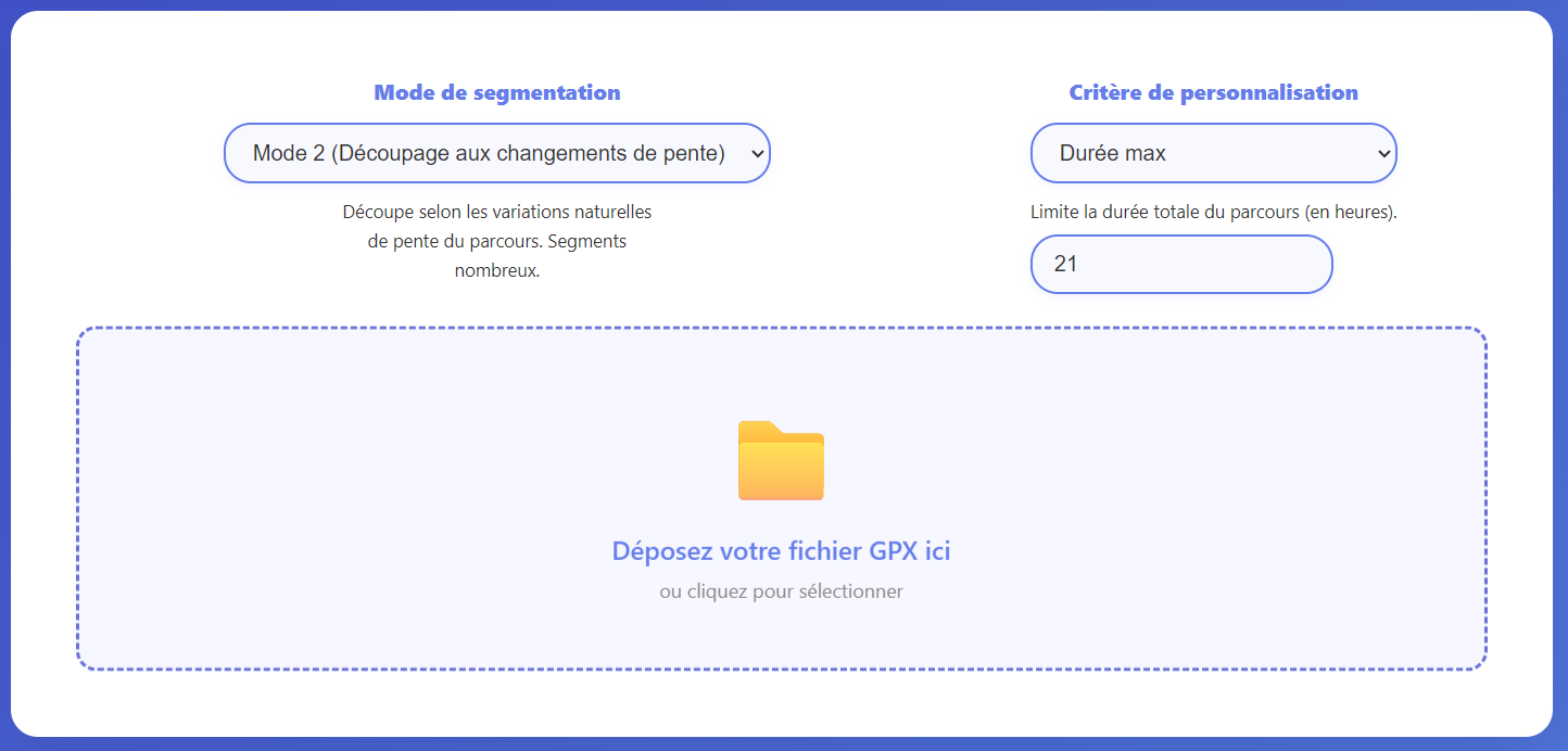
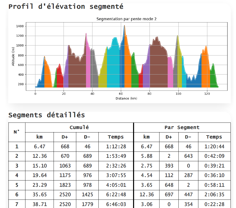
I import the EuskalTrail GPX file into Segly and select automatic segmenting mode #2: the one that adjusts segment length based on the slope. The result: short segments in technical or very steep areas, and longer ones on the rolling sections. Much more effective than a uniform kilometer-based segmentation.
I rename the project “EuskalTrail 130 — 21h” and save it. It seems basic, but being able to refer back to your strategy the day before the race without having to start all over again is priceless.
4. The fatigue factor: why I’m starting at 15%
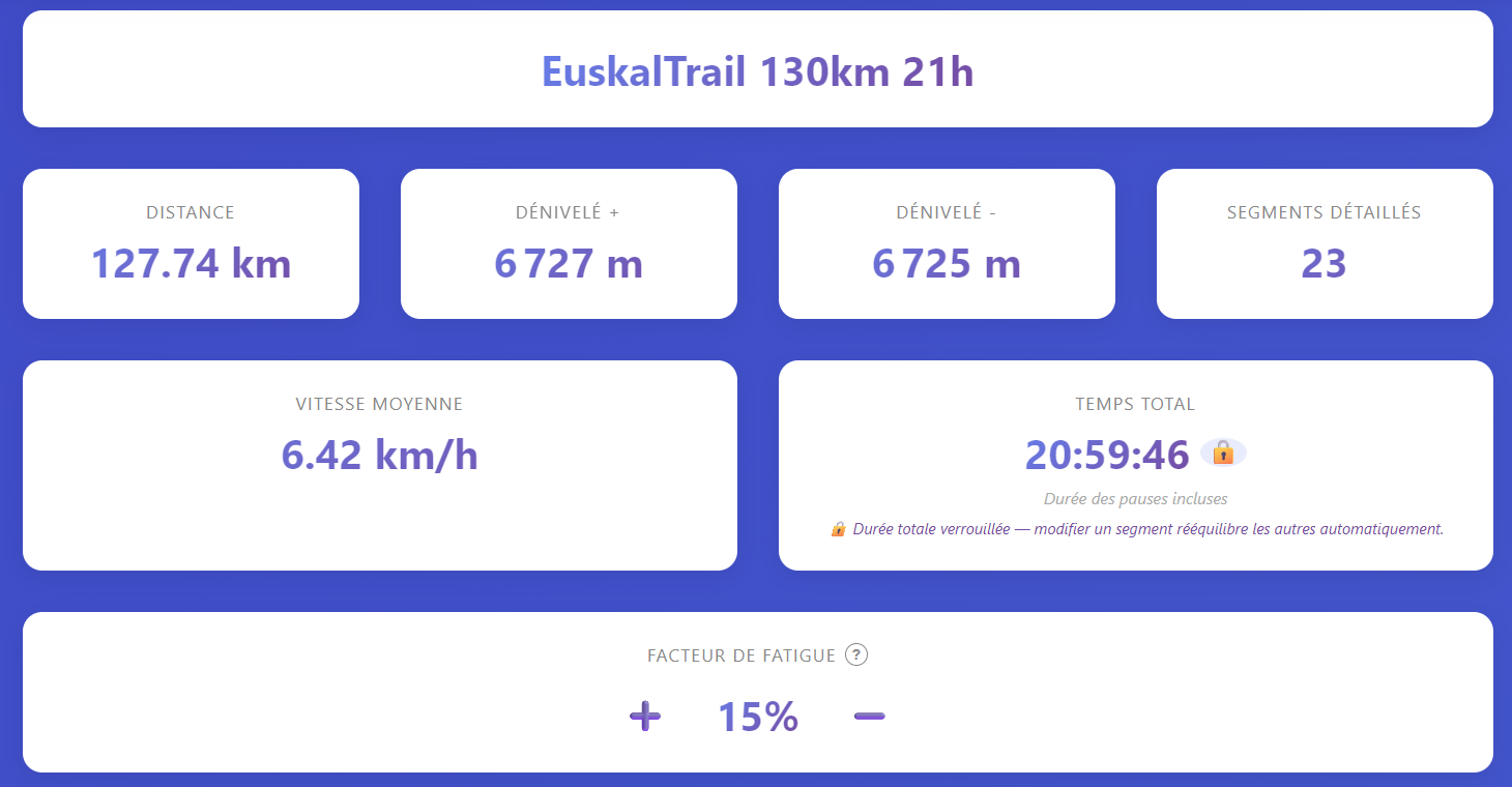
I set the fatigue factor to 15%. This means I plan to run the second half of the race 15% slower than the first. This isn’t pessimism—it’s realism.
In an ultra, expecting to run at a constant intensity from start to finish is an illusion. And if you still have doubts, take a look at the analyses I’ve done of the 2022–2025 UTMB winners (see the article on the UTMB fatigue factor): their fatigue factors all hover around 10 to 15%. Starting out too cautiously often means wasting time when you’re still fresh. The key is to embrace the positive split by keeping it under control.
5. Visualization: Map + Profile—It All Comes Together
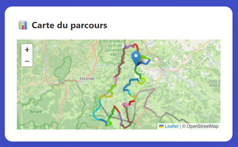
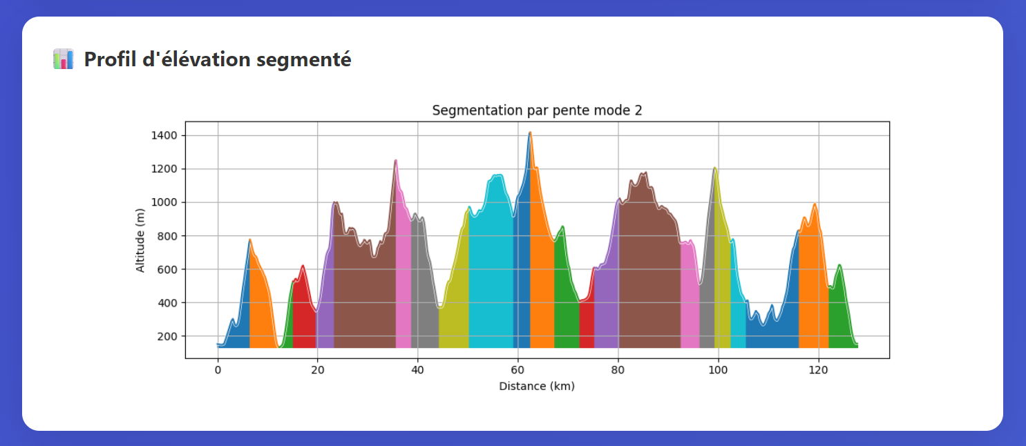
We run the analysis. Immediately, the map and elevation profile light up: each segment has its own color, progression factor, and estimated time. At a glance, I can visualize the profile—where the tough parts will be—and how the effort is distributed over 130 km.
That’s when the preparation really becomes tangible.
I also look at the overall statistics, which can be intimidating when viewed as a whole but are much more manageable when broken down into smaller segments. I take this opportunity to lock in the total duration so that future adjustments won’t change it.
6. On-the-ground adjustments: because the GPX file doesn’t tell the whole story
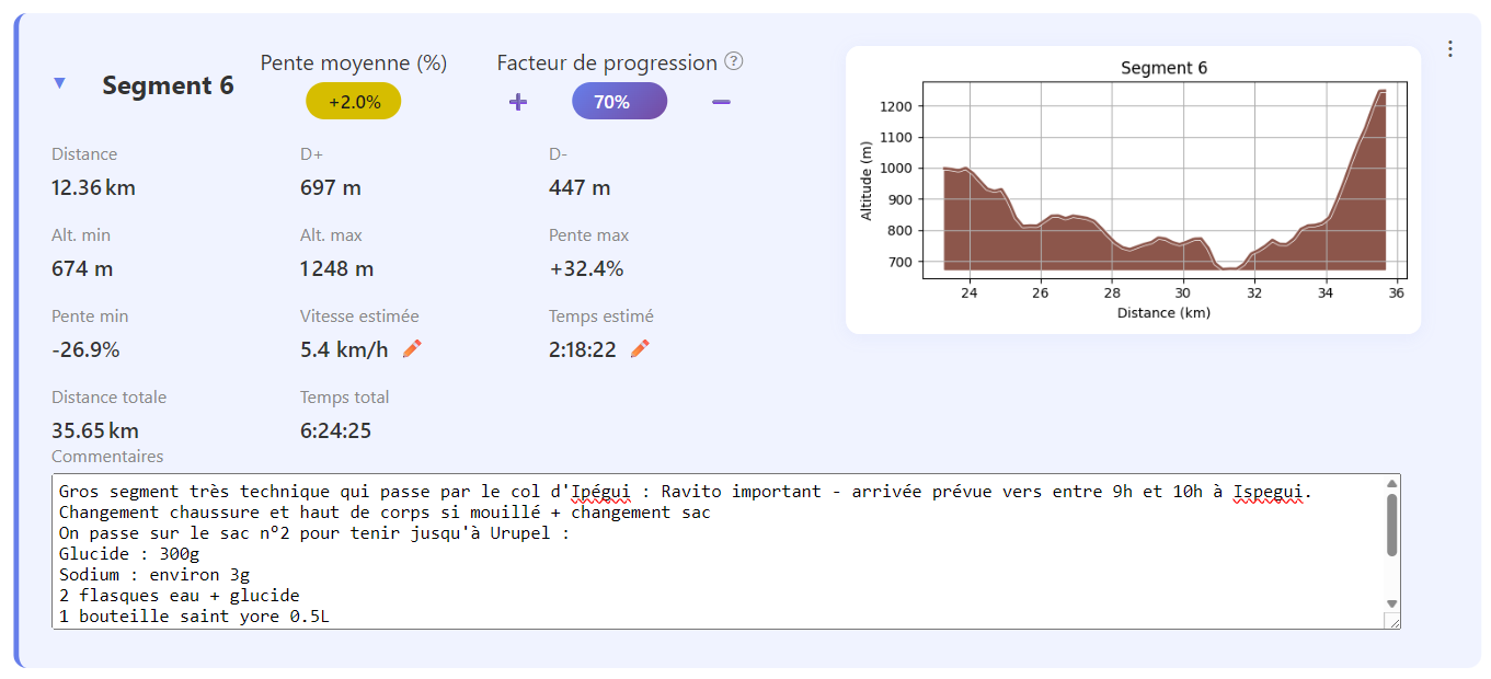
An algorithm doesn’t know the trails. I do. Thanks to the scouting I’ve done, I refine the route segment by segment:
- Km 0–10: very fast-paced, easy route. I slightly increase the pace factor.
- Km 23–35 (Iparla area): very technical, scree slopes, challenging ridges. I reduce the factor—no way am I going to burn out here.
- Km 100–120: will be run at night, moderately technical terrain with reduced visibility. I lower the factor a bit to stay on the safe side.
- Weather: No extreme heat expected, so no need to lower the factor between 11 a.m. and 6 p.m. as I would during a summer race.
Each adjustment is immediately reflected in the split times. It’s an iterative process, and it’s powerful.
7. Segment comments: the built-in logbook
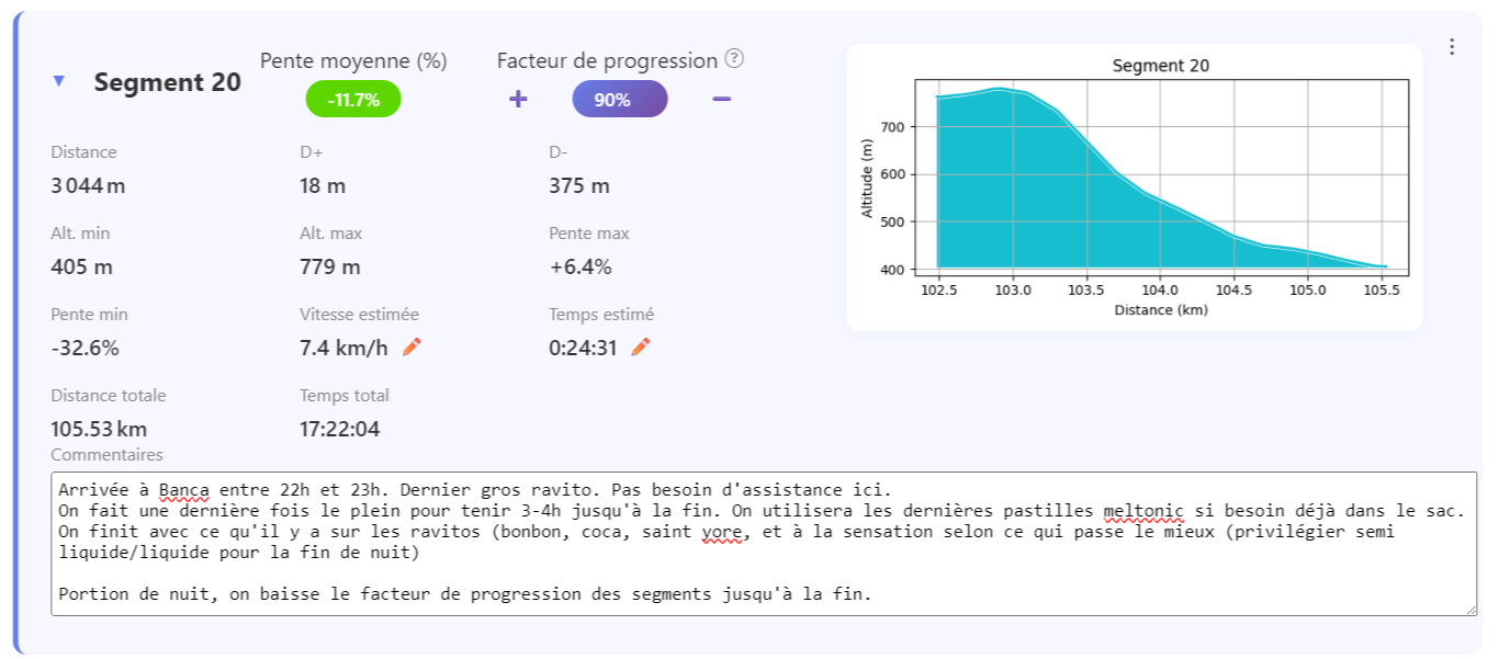
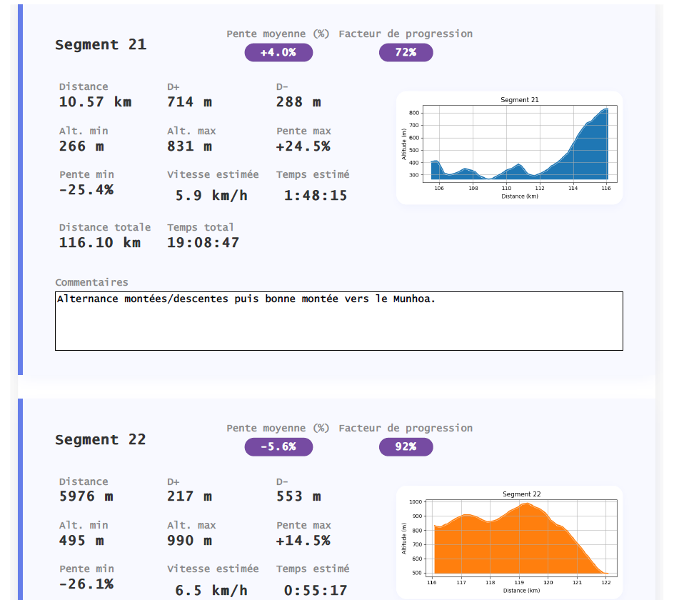
This is my favorite part. I go through each segment and add personalized comments. It becomes a real logbook:
- Geographical landmarks: names of mountain passes, villages, key points—to help me orient myself during the race even when my brain is getting tired
- Support and aid stations: which ones not to miss, what I need to grab there
- Nutrition strategy: which segment to refuel on, how many gels/bars/drinks, what I’ll leave at the support station
- Clothing strategy: changing socks, shoes, adding a layer—everything is planned in advance
- Poles: I note whether to carry them (uphills) or stow them (technical downhills, flat and rolling sections)
At the finish, each segment tells a story. It’s no longer just a time—it’s a complete race plan.
8. We re-adjust the segments: aid stations must be placed in the right spots
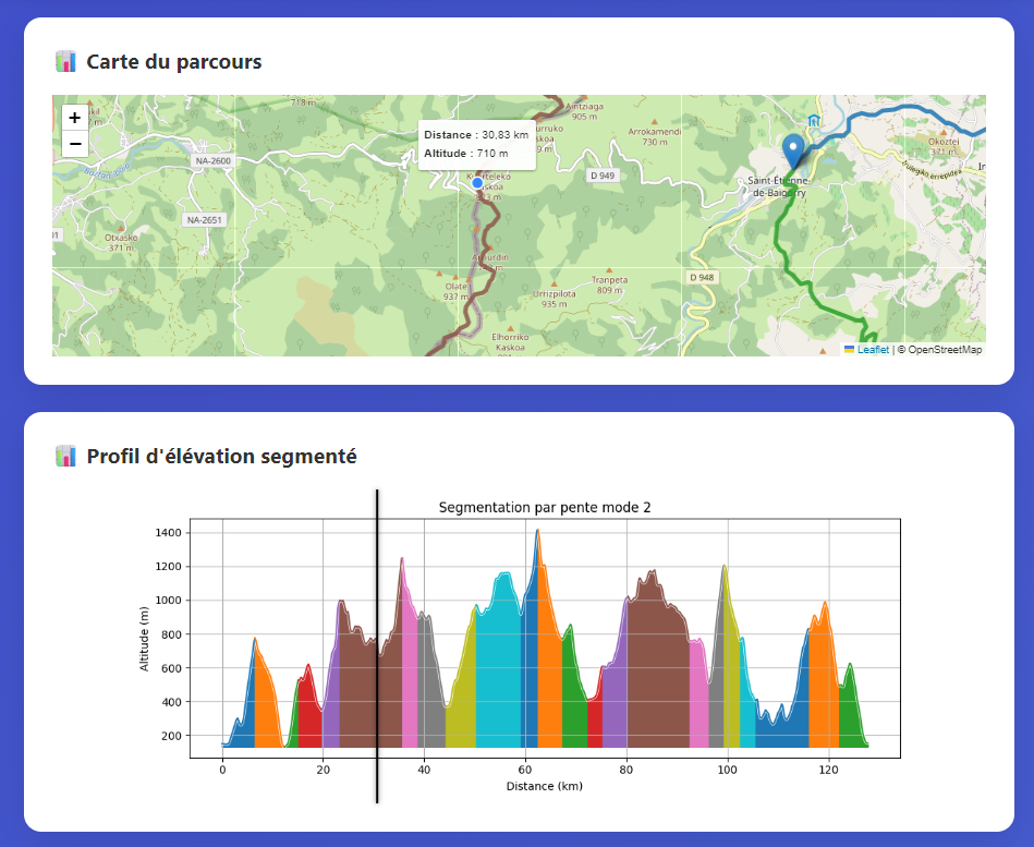
We make sure that key waypoints align properly with the ends of the segments. This isn’t always the case with automatic segmentation.
For example, I split Segment 6 in two:
- Segment 6: from the summit of Iparla (km 23) to the Col d’Ispegui (km 32)
- Segment 7: from the Ispegui Pass to the summit of Autza (km 36)
Result: I now have a precise arrival time at the Col d’Ispegui, where my support team is waiting for me. Nothing is left to chance.
9. Exporting and sharing: everyone in the loop
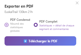
The strategy is finalized. One last review, and then we export:
- Full PDF: all sections, all comments, the entire strategy—for my team
- Condensed PDF: the essential timing details—possibly printed out and tucked into my pocket
I then generate the read-only sharing link and send it to my assistant. She can access my entire strategy from her phone—no account required, no hassle.
10. Plan B: Duplicate in 30 seconds
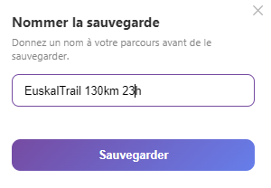
I duplicate the analysis, rename it “EuskalTrail 130 — 23h,” and all the times are automatically recalculated. I also share this link with my support team.
If Plan A falls apart, everyone knows what to do. No panic, no improvising.
11. Strategy finalized. We’re ready.
The strategy is in place. My support team has everything right in front of them; we’ll go over it together before the start so they know every detail.
As for me, I know exactly what to expect segment by segment: split times, aid stations, nutrition, clothing, and the tough moments I’ve anticipated.
All that’s left to do is run.
Want to build your own strategy before your next trail race? Upload your GPX file to segly.vo2run.app—it’s free, takes 10 minutes, and can make all the difference on race day.